After two postdoctoral experiences, at Eawag (the Swiss Federal Institute of Aquatic Science and Technology), and then at the University of New Hampshire (United States), Dr. Myriam Benkirane joined the ranks of Mohammed VI Polytechnic University. There, she continues her research on hydrological modeling and remote sensing, in collaboration with the Massachusetts Institute of Technology (MIT) in Boston.
Hydrological modeling of extreme hydrological phenomena relies on the integration of several categories of parameters and data, such as intense precipitation, flash floods, and pluvial or oceanic floods. It must overcome three major obstacles:
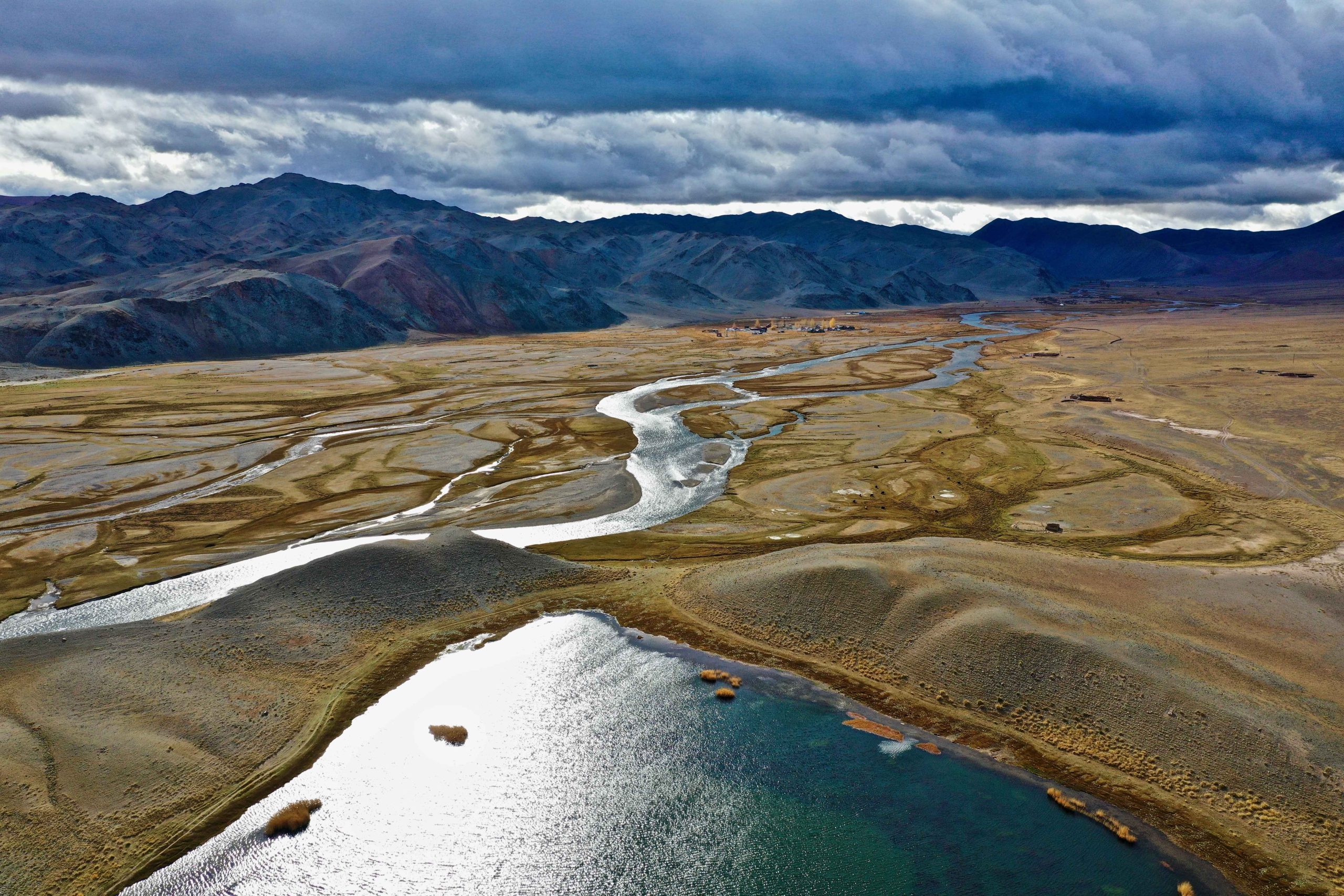
- There are not enough data measurement stations in arid mountainous environments.
- We are dealing with a non-stationary climate largely caused by climate change. The climate, once humid in some regions, has become arid due to climate change and the drying-up of water resources.
- Finally, there are combined events, a crucial field to which researchers must be particularly attentive. These events are complex because, for example, they may combine intense precipitation with sea-level rise or spring snowmelt, causing significant material (infrastructure destruction) and human damage.
So what must experts like us do in practice? We combine statistics of non-stationary extreme events with rainfall–runoff and rainfall–hydraulic models in order to provide managers with indicators on, for example, flood risks. These are universal models, meaning physical, stochastic, and conceptual models.
We can thus model a flood event using precipitation and other parameters such as temperature, soil moisture, snow level, etc., to calibrate a discharge and compare it with observed discharge. But the gaps in observed discharge remain a major question. How can these gaps be filled? Does the simulated discharge truly match the observed discharge, or do we have underestimation or overestimation?
Limits of Current Modeling
Pressure on water resources makes hydrological modeling and probabilistic forecasting essential, particularly regarding flood risk. Another tool is scenario planning. What does it consist of? Drinking water resources are distributed among user sectors by assigning them a quota in the form of a percentage. The sectors are very diverse: agriculture, ecology, cities, irrigation of green spaces, gardens, forests, etc. In the end, this work requires trade-offs that must be made by public authorities.
Hydrological modeling also concerns the state of water stocks. We quantify groundwater stocks, glaciers, lakes, rivers, and oceans to determine how these stocks evolve—how they increase in some regions and not in others. This assessment helps us understand how the water cycle behaves under the effects of climate change.
Quantifying stocks is not straightforward. For example, in Morocco, the quantification of water stocks in its dams is distorted. Why? Because large quantities of sediment accumulate during each flood. Due to lack of vigilance, dredging and bottom flushing are not performed, which allows sediment to accumulate year after year. When precipitation occurs, the water height is measured and noted as increasing by 20 mm, for example. However, this water layer rests on sediment that should be removed to obtain an accurate measurement of actual water volume.
We must have real stock quantities to make meaningful forecasts. What is a forecast? It relies on historical data, validated with present data, to determine the future. Therefore, if our present data are not correct, we must face many uncertainties regarding future forecasts.
It is a matter of algorithms, data, and artificial intelligence. But that is not all. If the observed data are incorrect, neither the algorithms, nor artificial intelligence, nor any robust model can fix it. The forecast will be false. There will always be uncertainty. Although we can calculate uncertainty, it will never disappear because there is also the uncertainty linked to measurement instruments.
A Relatively Rudimentary Alert System for Now
For now, by combining our extreme-event statistics and rainfall–runoff models, we provide managers with usable risk indicators. Decision-makers use these indicators to practice sustainable resource management.
How do we move from the model to the alarm? In each field site, we install meteorological or hydrometeorological stations, depending on what we want to measure. If we want to measure climatic characteristics and discharge, we install hydrometeorological stations generally used by hydrologists. These data are recorded at fine time steps; we can use them freely in our laboratories. We have data measured at intervals as short as two minutes.
We can therefore rescale data upward or downward, since the minimum interval is two minutes. We then need certain data such as land cover, forest cover, or agricultural cover. These data are extracted from satellite databases. There are, of course, institutions such as ORMVA or ABHT in Morocco that have such data. But generally, we rely on satellites to obtain clear data without cloud cover.
We then use our statistics. Our forecasts are not integrated into global alert systems that give farmers information about soil conditions, humidity levels, or weather. Currently, we have fairly basic, traditional alert systems. We trigger siren alerts only 30 minutes—or even one hour—before an extreme event occurs, to inform the population that a flood, for example, will occur.
Toward More Reliable and More Robust Models
We therefore rely on satellite data, which we correct to obtain relatively accurate data for our research and models. We are working on developing models sufficiently robust to handle all these uncertainties. We are moving quickly toward the development of highly reliable models.
Our team is currently working on robust and intelligent alert systems to predict extreme events and provide farmers with time intervals with reduced uncertainty. We will inform farmers if their land will be flooded, and provide them with information on soil moisture content. We will offer farmers a decision-support tool that integrates into the set of tools used by connected farmers who rely on new technologies.
These will be complex tools combining field data, satellite observations, and stochastic, conceptual, and physical models. Ultimately, it is a complex of models that will result in a single model giving farmers exactly what they need.
What I can propose to decision-makers is already a hazard anticipation tool. With my team, we will develop an anticipation tool. We will have a tool to forecast precipitation and river water levels that is quite reliable, with some uncertainty but far less than traditional alert systems. We will also provide water management systems. These will be applications that provide not only current weather and soil conditions but also guidance on how to manage available water.
Biography of Dr Myriam Benkirane
After several international research experiences in Europe and North America, Dr. Myriam Benkirane joined Mohammed VI Polytechnic University. There, she continues her work on hydrological modeling and remote sensing, in collaboration with the Massachusetts Institute of Technology (MIT) in Boston. Her research follows an integrated approach aimed at strengthening the hydrological resilience of arid and semi-arid regions facing climate change, through the development of hybrid models and intelligent early-warning systems based on artificial intelligence, satellite observations (GRACE, SWOT, SMAP), and field data.